


ID :
237857
Sat, 04/28/2012 - 08:24
Auther :
Shortlink :
https://www.oananews.org//node/237857
The shortlink copeid
AL Soiree With PG Sheiks, Repeated In Cairo
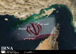
Tehran, April 28, IRNA - Arab League with a request from the United Arab Emirates and support from the littoral states of the Persian Gulf held an extraordinary meeting in Cairo to discuss three Iranian islands in the Persian Gulf and wrapped up its work with its usual statement.
In the Cairo meeting, Arab League asked Iran to negotiate with Emirates and listen to the demands of this Sheikdom.
Abu Dhabi has claimed that President Ahmadinejad’s recent trip to Abu Mussa Island can create tension in bilateral and regional relations and, with this justification, asked for convening Cairo meeting.
Emirates has made these claims while available documents in the British historical and security archives, as well as historical and official documents of the United Nations show that the three Islands of Abu Mussa, Greater and Lesser Tunbs and even more than that have been part of Iranian territory.
Britain was once the colonial power in Emirates.
Since about 22 centuries ago, not only the three aforementioned islands, but all the Persian Gulf islands and its southern coast were under Iran’s authority which lasted until the beginning of British colonial presence in the Persian Gulf.
According to these available and well-founded documents, in a naval map of the Persian Gulf, drawn by the British in 1786, Persian Gulf islands and ports have been divided into five groups. In the fourth group which are part of Iranian territory, the two islands of Tunb and Abu Mussa have been recognized as Iranian islands.
These islands were administratively part of the Iranian port Bandar Lenge in those years.
In 1885, the then Iranian Government decided to change the administrative division of Iran which had been left from the Safavid Dynasty and divided Iran into 27 provinces and ports and islands were part of the 26th province.
British colonial officials always admitted Iran’s sovereignty over the Iranian islands.
Lord Curzon ,who was appointed as Viceroy and Governor-General of India in 1899, has written in one of his books that Bandare Lenge and its nearby islands were ruled by the sheikh of Qassemian tribe who resided in the town and was the representative of Iran.
On the other hand, all the British official maps show Abu Mussa and Tunb Islands as part of Iran’s territory.
For instance, British Ambassador to Tehran in 1888 presented a copy of an official map of the Persian Gulf to Nasseredin Shah in which the three aforementioned islands are in the same color as Iran’s territory.
Even Sir John Malcolm, who persuaded the idea of seizing Persian Gulf islands, in his three trips to Iran (1800-1811) recognized Iran’s sovereignty over the islands and admitted that the islands are Iranian in a treaty signed with the then king of Iran.
In a map drawn by the Malcolm delegation, the three islands are in the same color as the territory of Iran. Iran’s sovereignty over the islands was recognized later many times and the 1814 Treaty between Iran and Britain is only one of them.
In the 1834 map of Central Asia drawn by major Alex Burns, the islands are in the same color as Iran’s territory, too.
The same fact can be seen in the historical map of Major Maurice and British Navy in 1863 and its later editions in 1876, 1890,1900, and 1912.
Captain Saint John drew the political map of the Persian Gulf in 1876 in which the disputed islands are in the same color as Iran territory.
There are many other maps to reconfirm the same fact; for instance the map drawn by the British Navy in 1881, the map drawn by British Ministry of Defense in 1886, map of British Foreign Office in 1888 which was reprinted many times later
In 1892, a color map of Iran was drawn under the supervision of Lord Curzon in which the Islands of Abu Mussa, Greater and Lesser Tunbs were part of Iran’s territory./end