


ID :
316184
Tue, 02/04/2014 - 08:36
Auther :
Shortlink :
https://www.oananews.org//node/316184
The shortlink copeid
10-digit geo-addresses for 124,000 buildings in Dubai
Abu Dhabi: Unique 10-digit digital address system to find out any location through the emirate’s own electronic map application.
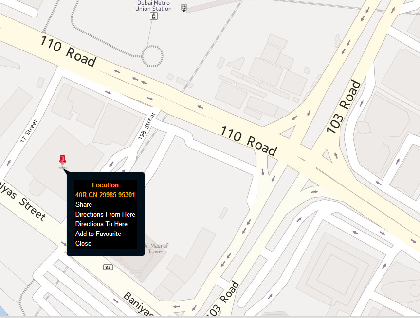
From February 16, residents and visitors in Dubai will be able to use a unique 10-digit digital address system to find out any location through the emirate’s own electronic map application. Developed by the GIS Department of the Dubai Municipality, the app, called Makani, will officially be launched on Apple App Store and Google Play on February 16, said the Director of the department, Abdul Hakim Malik. Earlier, the municipality had announced a soft launch of the app as a trial run. Now, it has fine-tuned the application and will make the official launch with an improved version.
Speaking at the Middle East Geo-Spatial Forum 2014, which began in Dubai on Monday, Malik said the department will begin distributing the 10-digit geo-address for 124,000 buildings in Dubai after the official launch of the app. These include government organisations, hospitals, schools, hotels, commercial buildings, houses, factories and warehouses across Dubai including free zones and Hatta. “Now onwards, people will just have to remember 10 digits which they can use in the app to find exact location to the entrance of the building they want to go to,” Malik told Khaleej Times. Entering the code of any building on the application ‘makani.ae’ will allow one to find the specific building with an accuracy of within one metre from the entrance. Users can also get the code for any building by searching for its name.
For example, the Dubai Municipality’s main building in Deira can be located by searching its name or by its coordinates for the building 30002 95324.
“We opted for the number system for the address because we have over 200 nationalities speaking more than 100 languages in Dubai. With the number system, there will be no more confusion in identifying any place, building, street or locality in Dubai,” said Malik.
Once inside any mall or main building, Malik said, people can also use Wi-Fi to identify and share their location. The next phase of the project would be mapping each and every shop in Dubai under different categories
The live traffic view on the app will help motorists choose routes with less traffic to reach their destination faster. The app also allows users to search for hospitals, commercial establishments or other services around their location by clicking on the ‘nearby’ tab. Options for seeing satellite and map views, and for getting directions from one destination to another are also available. The app helps motorists take routes that don’t have the Salik toll.
Emergency services, police and civil defence officials are expected to start using the DM’s new app to find locations faster.
Malik said the coordinate converter allows people to use the map in any GIS system. The latest navigation product from Garmin, the municipality’s partner in the project, has already incorporated the municipality’s system into it.
The digital address system, Malik said, will also stand in good stead for Dubai as it prepares to host World Expo in 2020. “By 2020, our system will be perfect and I can foresee people using their geo-coordinate number on their business cards to specify their address.”
Earlier, Hussain Nasser Lootah, the Director-General of Dubai Municipality, inaugurated the two-day forum. He said the geo-spatial projects are the backbone of any government and Dubai has incorporated many of them in its journey to become a smart city. – Khaleej Times – Read more: http://www.khaleejtimes.com/nation/inside.asp?xfile=/data/government/2014/February/government_February20.xml§ion=government